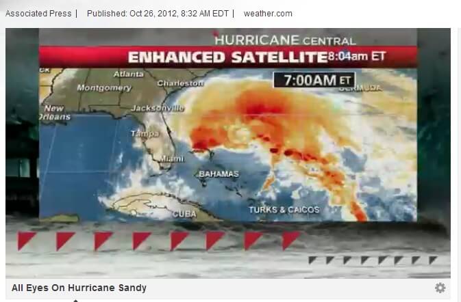
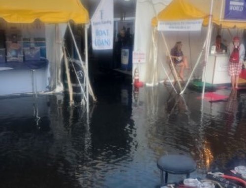
Hurricane Sandy approaches the East Coast and European computer models predict that it will hit just south of Ocean City, MD. The northern side of the storm tends to develop more flooding and the winds will push water out of the bays and tributaries on the southern side of the storm. The storm won’t hit until Monday, but in the European model, the winds will create flooding to the north of the storm beginning on Sunday. The American model has it moving more slowly and hitting farther north but hanging over the tri-state area around NY and New England through Thursday. As we hear more, we will keep the site updated.
If the European model is accurate, it looks like Annapolis could be in for some significant flooding. If the American model wins, Annapolis flooding shouldn’t be as significant.
Either way, large waves in Ocean City, MD will be the rule of the day beginning this weekend.
You’ve heard there is an app for that and there really is.
From your mobile phone, call “**REDCROSS” (**73327677) and they will send you a link to download the app to your phone or you can download them directly from the iTunes or Google Play app stores.
For now, here is the Weather Channel’s article regarding the storm:
Forecasters warned that Sandy will likely mix with a winter storm to create a monster storm in the eastern U.S. next week whose effects will be felt along the entire Atlantic Coast from Florida to Maine and inland to Ohio.
A new tropical storm watch was issued early Friday for a section of the U.S. East Coast extending from Savannah, Ga., northward to North Carolina’s Outer Banks.
Sandy, which crossed Cuba and reached the Bahamas as a category 2 hurricane, was expected to maintain its category 1 storm status for the next few days.
In the Bahamas, power was out on Acklins Island and most roads there were flooded, government administrator Berkeley Williams said.
On Ragged Island in the southern Bahamas, the lone school was flooded.
“We have holes in roofs, lost shingles and power lines are down,” said Charlene Bain, local Red Cross president. “But nobody lost a life, that’s the important thing.”
Steven Russell, an emergency management official in Nassau, said docks on the western side of Great Inagua island had been destroyed and the roof of a government building was partially ripped off.
Sooner Halvorson, a 36-year-old hotel owner from Colorado who recently moved to the Bahamas, said she and her husband, Matt, expected to ride out the storm with their two young children, three cats, two dogs and a goat at their Cat Island resort.
“We brought all of our animals inside,” she said, though she added that a horse stayed outside. “She’s a 40-year-old horse from the island. She’s been through tons of hurricanes.”
On Great Exuma island, guest house operator Veronica Marshall supplied her only customer with a flashlight and some food before Sandy bore down. She said she was confident that she and her business would make it through intact.
“I’m 73 years old and I’ve weathered many storms,” she said.
Florida and Northward
Winds were picking up Friday morning along Florida’s southeastern coast, the Upper Keys and Florida Bay. Winds could be as high as 60 mph, said Jim Cantore, meteorologist with The Weather Channel.
Mike Seidel, meteorologist from The Weather Channel reporting from Singer Island, Fla, just north of West Palm Beach said Friday morning tropical storm force winds were being felt. “These waves are 4-5 footers, and we’ve got whitecaps as far as the eye can see,” Seidel said.
Cantore said conditions along the Florida coast would improve by Friday night.
Hurricane Sandy is expected to churn to head northward off the U.S. coast.
With storm conditions projected to hit New Jersey with tropical storm-force winds Tuesday, there was a 90 percent chance that most of the U.S. East Coast would get steady gale-force winds, flooding, heavy rain and maybe snow starting Sunday and stretching past Wednesday, U.S. forecaster Jim Cisco said.
Bryan Norcross, a hurricane specialist with The Weather Channel, said the long-term forecast for Sandy continues to be a challenge.
“Some things are coming into focus. It kind of comes up off the southeast coast by Saturday and zigzags up the East Coast — exactly where the worst of it is going to affect the northern part of the U.S.”
More information on www.weather.com
Mayor Josh Cohen urges emergency preparedness as Hurricane Sandy approaches.


Leave A Comment